

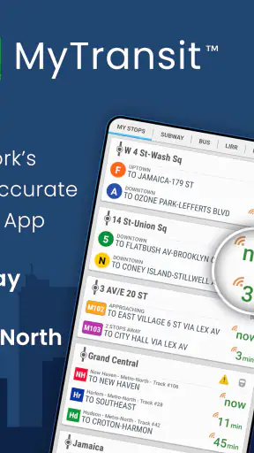
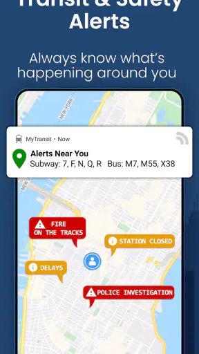
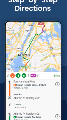
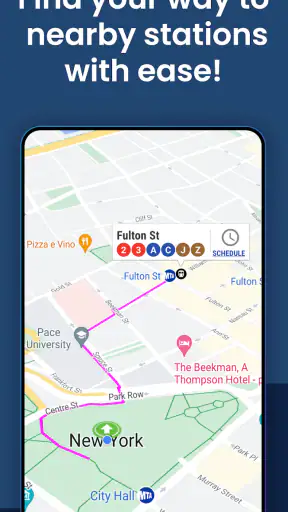
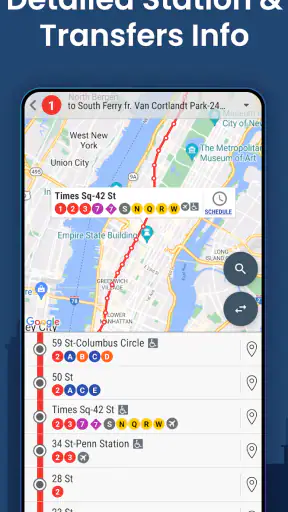
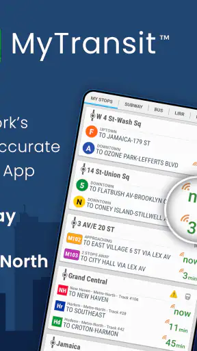
When I need to move around New York City without turning every transfer into a guessing game, I want a tool that stays focused on the transit network rather than trying to become an all-purpose travel companion. MyTransit NYC Subway & Bus MTA takes that approach. It is a free Maps & Navigation app from MyTransit™ built around New York City Subway, bus, Long Island Rail Road, and Metro-North schedules and maps. After using it as a practical planning aid, I see it as a particularly useful companion for riders who already know the city’s basic layout but want quicker access to route information.
The app has been around since February 12, 2012, and its long presence matters here. A transit app has to earn trust during ordinary moments: checking a platform direction before descending into a station, confirming whether a bus route serves a particular avenue, or comparing a regional rail option with a subway trip. MyTransit has attracted over one million installs, with a 4.6 average from around thirty-six thousand ratings and roughly nine thousand reviews. Those figures do not replace personal judgment, but they suggest that the app has found a durable audience among people dealing with New York transportation.
What MyTransit is really useful for
The strongest part of the experience is its concentration. Instead of burying subway and bus information inside a broad travel-planning service, it puts New York transit at the center. That makes it easier to open the app with a specific question: which line should I take, what does the route look like, or how do the city’s subway, bus, and commuter rail choices fit together?
I find that focus most valuable when I am already outside and need a fast answer. A visitor may use it to understand the difference between a subway route and a Metro-North journey, while a regular rider may use it to check a less familiar bus corridor or a Long Island Rail Road connection. The inclusion of both city services and regional rail is important because many New York trips do not stay inside one transportation system.
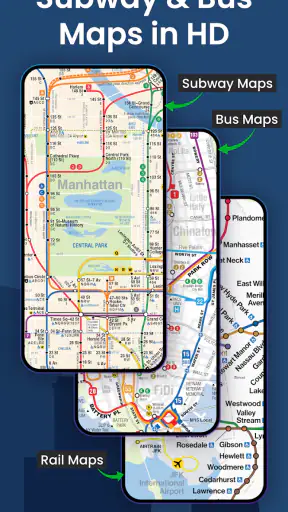
The maps are also more useful than a simple list of station names. A map helps me verify whether I am looking at the correct branch, whether a transfer is sensible geographically, and whether a station is actually near the destination I have in mind. That visual check can prevent a common mistake: choosing a route that looks efficient in a text result but sends me in the wrong direction before a transfer.
My practical advice is to use the app in two stages. Before leaving, look at the complete route and identify the key transfer or rail segment. Once outside, reopen it for the specific line or schedule detail you need. This avoids trying to reconstruct an entire journey while standing in a crowded station, where a clear map is often more helpful than a long set of directions.
Where its transit coverage makes a difference
Many navigation apps are excellent at producing a door-to-door answer, but they can make the transit system feel like a black box. MyTransit is better when I want to inspect the network itself. The subway and bus information is useful for understanding the available services, while the LIRR and Metro-North coverage makes the app more relevant for trips that cross between city neighborhoods and the wider metropolitan area.
That broader coverage creates a useful trade-off. If I already know the station or line I want to investigate, MyTransit can feel direct and uncluttered. If I am starting with only an address and need walking directions, traffic conditions, ride-hailing choices, or a complete multi-modal itinerary, a general mapping service may be more convenient. I would not treat this app as a replacement for every navigation tool on my phone.
It is especially well suited to three kinds of riders. First, regular New Yorkers can use it as a dedicated reference for routes they do not take every day. Second, visitors who find the subway map intimidating can use the visual network to build confidence before boarding. Third, commuters who combine city transit with LIRR or Metro-North can keep those systems in one transit-focused place instead of switching between unrelated apps.
Reading the app without overtrusting it
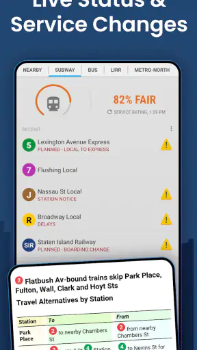
A transit app can make a route look certain even when the real journey is affected by crowding, maintenance, weather, or an unexpected service change. I treat MyTransit as a strong information aid, not as a guarantee that the next train or bus will behave exactly as planned. That is not a criticism unique to this app; it is a basic limitation of digital transit planning.
For an important appointment, I would check the route early, leave room for a missed connection, and confirm the final service details shortly before departure. The most reliable workflow is not to stare at one predicted arrival time, but to understand the route structure: the line, direction, transfer point, and alternative path. MyTransit is valuable because its maps and schedules help with that broader understanding.
One non-obvious advantage of this approach is that it can make disruptions easier to reason about. If one segment becomes inconvenient, a rider who recognizes the surrounding network can compare another subway line, bus corridor, or regional rail option more intelligently. The app does not need to make every decision for me; showing the system clearly can be more useful than presenting one supposedly perfect answer.
Trust, controls, and everyday privacy choices
MyTransit’s trust profile should be judged by what the app visibly lets me control and by how carefully I choose to use it, rather than by assumptions about unseen behavior. Its purpose is clear: transit maps and times. I would still review the permission prompts and privacy information shown on my own device before granting access, because permissions and data practices can change over time and may vary by platform version. I do not consider a transit app trustworthy simply because it has a familiar category or a large user base.
The app is free to download and use, with in-app purchases listed from ninety-nine cents to eight dollars and ninety-nine cents per item. That means I would pay attention to any purchase screen and read what an optional item provides before confirming it. A free starting price is convenient, but it should not encourage automatic approval of every upgrade or add-on. I prefer to keep purchase decisions deliberate, especially when handing the phone to a child or letting someone else use my device.
There is no reason to create more exposure than the task requires. If I only need to inspect a subway map, I would avoid granting unrelated access and would use the app in the most limited way that still solves the problem. If the app asks for a permission that feels unrelated to checking routes, I would pause and decide whether that access is necessary for my intended use. This is a practical habit for any navigation tool, not a claim about a particular permission request.
Account control is another area where I stay cautious. I do not assume that an account is required just because an app offers optional purchases or personalized settings, and I do not enter personal information unless I understand why it is needed. When an app presents a sign-in, subscription, or purchase choice, I look for a clear way to continue without it if my goal is only to view transit information. Keeping the use case narrow gives me more control over what I share and what I buy.
Situations where careful handling matters
Location is the most obvious sensitive moment in a navigation context. If I am planning a trip from a known station, manually selecting that station may be preferable to sharing my live position. If I am lost and need help identifying the nearest subway entrance, location access could be more convenient, but I would still check whether the permission can be limited and whether I can turn it off later in the phone’s settings.
Another sensitive moment is using the app on a shared phone. Search history, saved places, or recently viewed routes can reveal where someone has been or intends to go, depending on what the app stores and displays. I avoid entering private destinations unnecessarily, and I review visible recent activity when privacy matters. I also avoid making purchases while distracted in a station, where it is easy to tap through a screen without reading the details.
Public Wi-Fi creates a different kind of caution. I use it for ordinary route research, but I would not combine a rushed transit lookup with unrelated account changes or payment decisions. The safest habit is simple: check the route first, postpone sensitive account or purchase activity until I am on a connection and in a setting where I can read every prompt.
How I compare it with broader navigation alternatives
MyTransit wins when the question is specifically about New York transit. Its dedicated maps and coverage across subway, bus, LIRR, and Metro-North make it easier to think like a rider rather than like a driver following turn-by-turn instructions. I can study the network and make my own judgment about a transfer, which is useful when the fastest-looking route is not the most comfortable or understandable one.
A general map app is usually better when I need exact walking guidance from a restaurant to a station, a live view of several transportation modes, or directions that continue after I leave the train. A dedicated official service may be preferable when I want agency-specific alerts or operational notices. MyTransit occupies the middle ground: more transit-focused than a general map, but not necessarily the only source I would consult for a time-critical journey.
This comparison also explains who should skip it. If you rarely travel in or around New York City, a broad navigation app may be enough and will avoid adding a specialized tool to your phone. If your priority is live traffic, cycling, driving, or walking rather than subway, bus, and regional rail information, MyTransit is not aimed at your main need. And if you expect an app to remove all uncertainty from a disrupted trip, no transit map should be treated that way.
Version, device fit, and the cost question
The current version is 3.16.16, and the app supports devices running Android 6.0 or later. That makes it accessible to people who keep an older compatible phone, although the experience can still depend on the device’s screen size, speed, and system settings. Maps are easier to inspect on a larger display, while a compact phone is convenient for quick checks in a station. I would test the app before relying on it for a long trip, particularly if the phone is older or has limited storage and battery.
The Everyone content rating makes it suitable for a broad audience. Even so, I would explain purchases and permissions to younger users rather than handing over the phone without supervision. The age rating says the app is broadly appropriate; it does not remove the need to understand optional spending or location choices.
Because the app is free, it is easy to try without making a financial commitment at the start. The in-app purchase range means I would inspect the value of each optional item instead of assuming every feature is necessary. For my own use, the deciding question is whether the free experience already answers my route and map questions. If it does, I would keep the app simple and avoid paying merely because a purchase prompt appears.
A realistic trip workflow
Imagine I am leaving a neighborhood in Queens for an appointment near Manhattan, then continuing toward a destination served by Metro-North. Before leaving, I would use MyTransit to understand the subway portion, identify where the transfer occurs, and inspect the regional rail connection separately. I would note the station names and directions rather than memorizing only a single departure time.
At the first station, I would check the map again and confirm that I am entering the correct side of the route. During the transfer, I would use the schedule view for the next leg instead of reopening the entire journey from scratch. If the first option becomes inconvenient, the network view gives me a better basis for considering another line or bus connection. This workflow reduces the chance that I will make a rushed decision based on one unfamiliar station.
For a visitor, I would add one extra step: take a screenshot or write down the key transfer before going underground, where connectivity and attention may be less dependable. I would not rely on a screenshot for changing service information, but it can preserve the basic route shape. That distinction is important: keep the stable map relationship offline if useful, while checking current timing again when possible.
What I would improve in my own habits
The app encourages me to separate planning from navigation. Planning means understanding the line, station order, transfer, and rail system involved. Navigation means confirming where I am and what service I can take now. Mixing the two tasks can make any transit app feel confusing, especially when a route contains several branches or a regional rail connection.
I also avoid judging a route only by the number of transfers. A route with fewer changes may involve a longer walk, an unfamiliar station, or a less convenient connection. MyTransit is most helpful when I use its maps to make that judgment myself. The best route for a visitor carrying luggage may not be the same as the best route for a regular rider traveling light.
Finally, I keep a backup mindset. I know the broad direction of travel, remember the destination station, and leave enough flexibility for a missed connection. That is not because the app is unreliable; it is because city transit is a changing environment. A tool earns my trust more when I use it intelligently than when I expect it to predict every event.
My cautious verdict
I recommend MyTransit NYC Subway & Bus MTA to anyone who wants a focused reference for New York City subway and bus travel, especially if LIRR or Metro-North may also be part of the journey. Its maps and schedules make the network easier to inspect, and its long availability, broad audience, and strong average rating give it a credible starting point for trial.
My recommendation comes with boundaries. I would pair it with a broader map or an official service source when I need detailed walking directions, broader live travel context, or confirmation during a major disruption. I would also review permissions, privacy choices, and every in-app purchase screen rather than treating convenience as a reason to share or spend automatically.
The best reason to install MyTransit is not that it promises to make New York transit effortless; it is that it helps me understand the system before I commit to a route. For a regular rider, that can mean faster decisions and fewer wrong turns. For a visitor, it can turn an intimidating map into a manageable plan. If your needs are mostly outside New York transit, skip the specialized download. If the city’s subway, buses, or regional rail are part of your routine, this free app is worth testing with a careful, informed approach.


